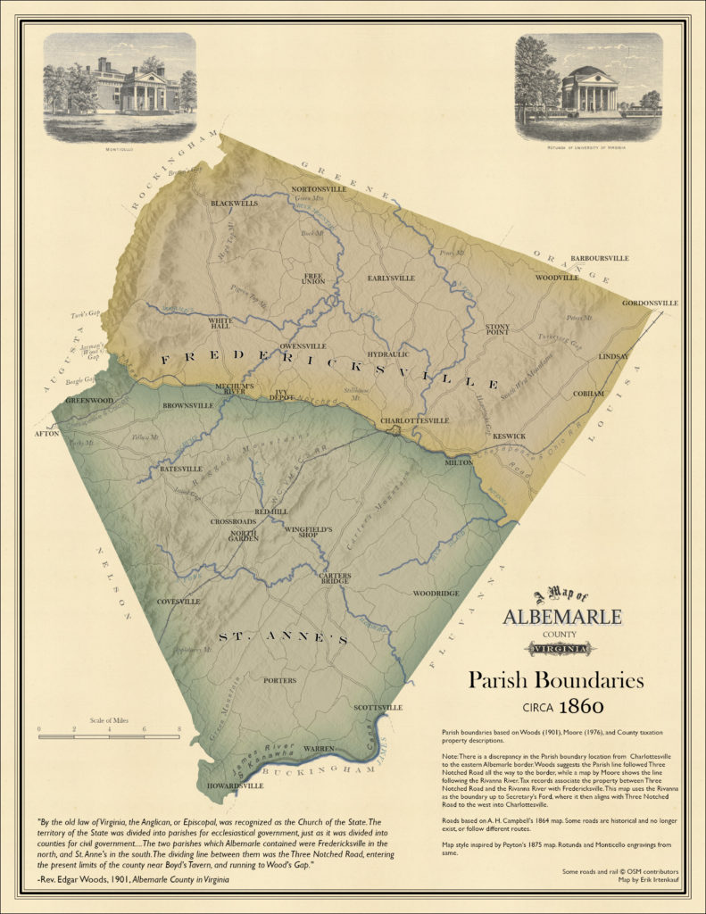
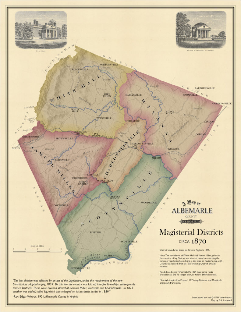
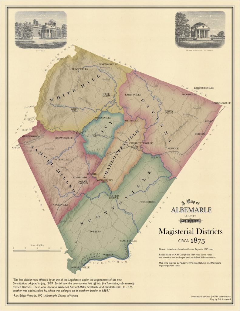
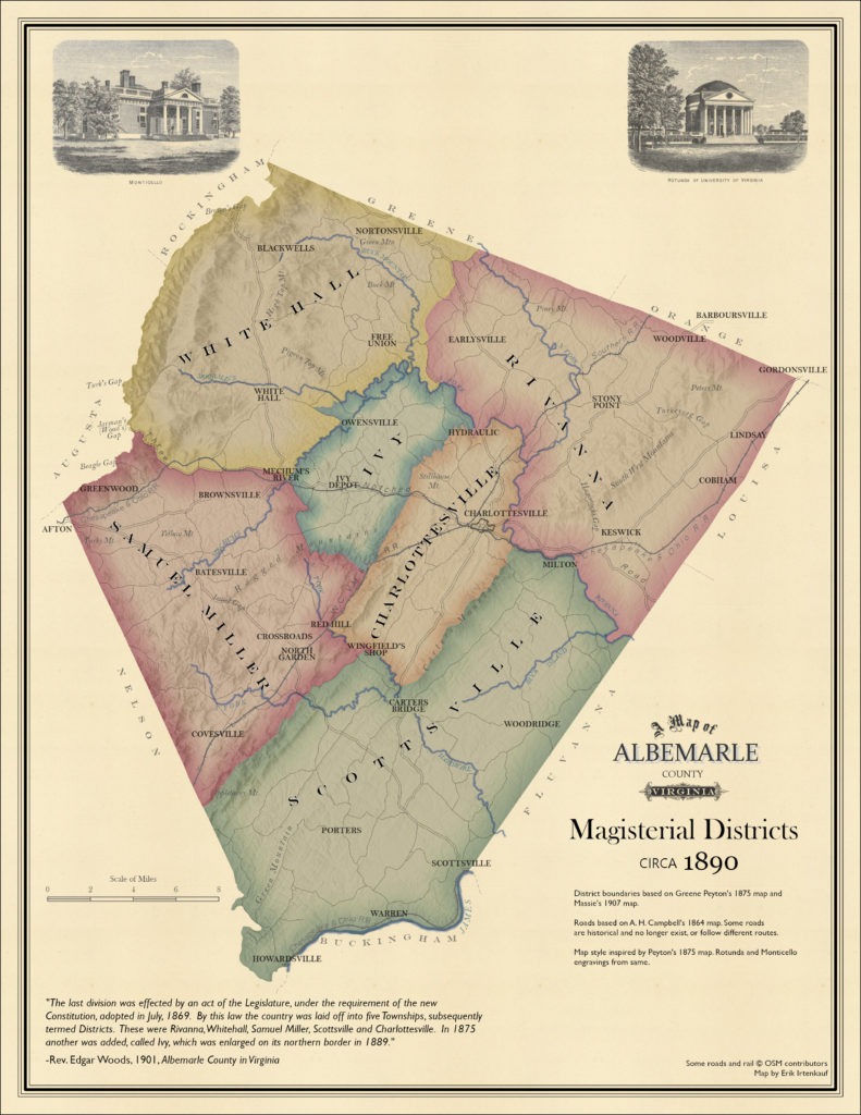
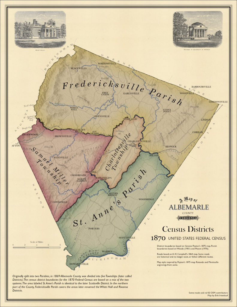
The reference maps on this page depict a variety of boundaries useful for understanding the history of Albemarle County. Many property and census records are organized according to these areas.
Parishes, Townships, & Districts
This collection of maps shows various internal administrative boundaries for Albemarle County in the mid to late 1800s.
Federal Census Districts
The following maps show census districts for the 1870 and 1880 Federal Census. They can be used to geographically place the people identified in those enumeration lists.
